My Dad sent me a link to an old photo of the 17-27 block of High Street taken in 1868 (see the link)
http://www.photogravure.com/collection/searchResults.php?page=2&view=medium&individual=8
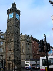
So I put on my good walking shoes and Taiga coat to prepare myself for the long walk in the rain and wind. It took me close to an hour to get there but I couldn't find that address. From what I can see that block is now a bank building. If you look at the photo I took the block should be where the grey brick building is on the left. As I crossed the square High Street was no more and I was now on Saltmarket Street.
I just kept walking and found myself on the River Clyde and I could see an interesting architectural arch, a monument in the background and something way off that looked like a greenhouse. I later found out that what I had discovered was a place called Glasgow Green and the greenhouse was part of a museum called the People's Palace.
I was cold and wet and there is free admission for all museums here so I decided to go in and check it out. If you go to my Flickr photo site you will get all the details on what I saw on the Green and what the museum is about but I digress. Let's get back to the original story.....
One of the displays in the museum was on the history of tenements in Glasgow. In looking at the display I found the same photo my Dad sent me. In reading up on the area it was mentioned that the conditions in the district had become so awful that entire blocks were demolished. So that explains why I couldn't find that block of buildings. Here's a quote from the Glasgow Merchant City website:
Tackling the Old Town Slums
The eastern end of Trongate and the backlands reaching towards the south were, with the High Street and its interface with the Merchants City core, a different matter, "Although the population had increased fivefold between 1801 and 1860 .... there was in the centre of this rapidly expanding conurbation a medieval city covering about 100 acres with narrow winding ill paved streets which were quite unsuited to the requirements of an industrial city. The central business district, including the new City Chambers (ie County Building) had moved west, leaving the declining areas to the poorest classes. Virtually no demolition took place, and .... former middle-class gardens were filled with jerry-built back tenements.
The Corporation's own minute tools (18 November 1875) confirmed that, by the 1860's between 500 to well over 1,000 persons occupied each square acre. In 1871, it was revealed that there were some 200 houses of ill-fame and 150 oshebeens within the small area around Trongate, Saltmarket and Bridgegate.
From the 1840s the Police Acts allowed the municipal authority some power to intervene to improve sanitation, control overcrowding and to demolish decayed buildings, but it was not until 1866 that the City of Glasgow Improvements Act made Glasgow the first British Council Authority to plan slum clearance on such a scale as that proposed. It was intended to be "the largest and most comprehensive single undertaking of this kind in the 19th century ten years before Birmingham on an area twice as big" 18 By 1874, 77 acres had been bought at a cost of £1,317,700 and the homes of 15,425 people destroyed. By 1876, 25375 people had been displaced into significantly better homes.
So, going back to the photo my Dad sent me the link to and taking a closer look at the date and the condition of the buildings (notice the tops) I think this may have been taken either just before the mas demolition took place, or as it was taking place.
So there you have it.


Acelera tu riqueza con interés compuesto
-
El interés compuesto es considerado uno de los conceptos más poderosos en
el mundo de las finanzas. Albert Einstein lo llamó “la fuerza más poderosa
…
...
4 weeks ago
No comments:
Post a Comment